Trump Satellite Data Cut: Hurricane Forecasting Faces Major Setback Amid Controversy
Trump Satellite Data Cut Raises Forecasting Concerns
The recent Trump satellite data cut has stirred widespread alarm among meteorologists and climate scientists. The Department of Defense (DoD) has announced it will no longer share critical weather satellite data with civilian agencies like NOAA and NASA, a move that threatens to impair hurricane forecasting during the peak of the Atlantic hurricane season.
Trump Satellite Data Cut Delayed but Not Cancelled
Originally slated to take effect by the end of June, the Trump satellite data cut has been temporarily delayed until July 31, 2025. This reprieve came after pressure from NOAA and NASA officials, particularly Dr. Karen M. St. Germain of NASA, who formally requested the postponement. However, experts argue that this delay does not mitigate the risks posed by the long-term loss of access to essential satellite data.
Impact of Trump Satellite Data Cut on Hurricane Predictions
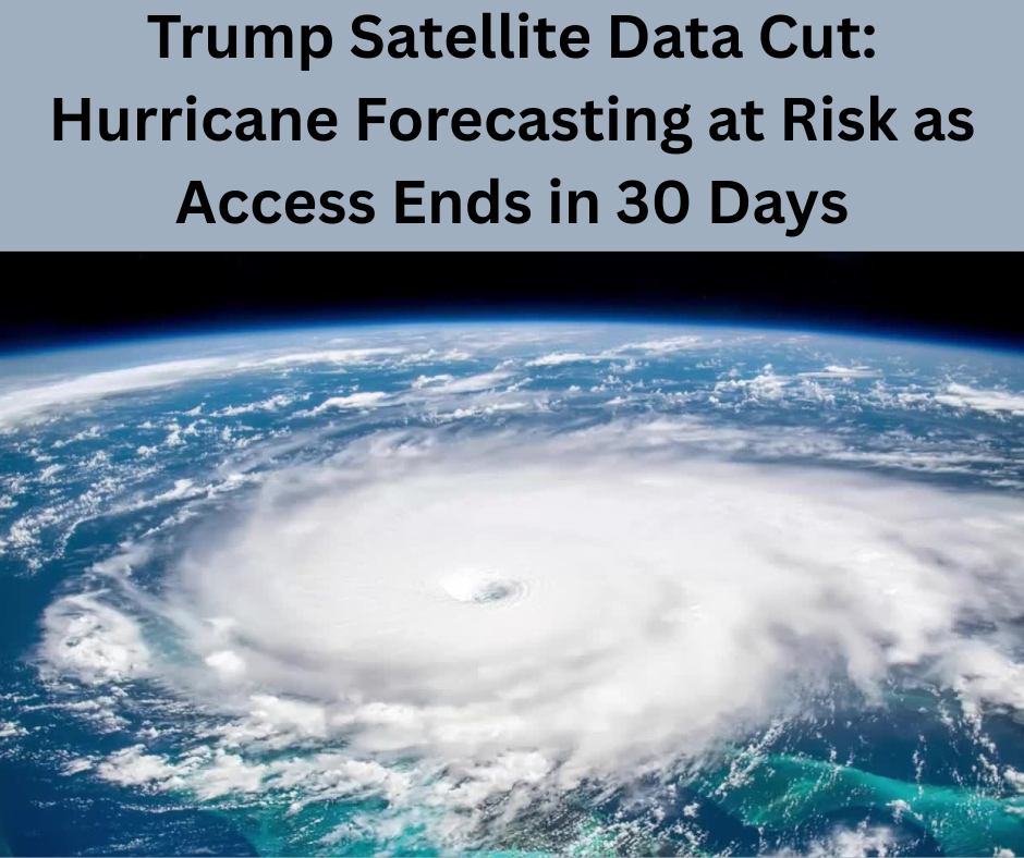
The Trump satellite data cut involves the Special Sensor Microwave Imager Sounder (SSMIS), a sophisticated instrument aboard Defense Meteorological Satellite Program (DMSP) satellites. These tools offer a 3D view of tropical systems, detecting internal structures of storms and helping meteorologists predict rapid intensification—an increasingly frequent and dangerous phenomenon due to climate change.
Forecasting agencies like NOAA rely heavily on this data to track the development and movement of hurricanes, especially at night or when aircraft reconnaissance isn’t possible. Losing access to SSMIS data could leave significant blind spots in storm predictions, which might delay critical warnings for areas in a storm’s path.
Why the Trump Satellite Data Cut Is Happening
According to DoD and U.S. Space Force statements, the Trump satellite data cut stems from cybersecurity concerns over the transmission methods used between military and civilian agencies. However, no clear explanation has been given for the abrupt termination, which many insiders, including former NOAA and NASA scientists, claim came as a shock.
Meteorologists Warn of Serious Risks from Trump Satellite Data Cut
Experts are already warning of potentially dire consequences. Brian McNoldy from the University of Miami described the Trump satellite data cut as “alarmingly bad news,” highlighting the heavy reliance on DMSP data for near-real-time insights. Hurricane forecasting models, especially those focusing on rapid intensification, will be hamstrung by the loss of nearly half of all available microwave data.
Michael Lowry, a former NOAA scientist, emphasized the gravity of the situation, noting that without DMSP, the chances of missing rapid intensification events or misplacing storms in forecasts will significantly increase.
Trump Satellite Data Cut’s Broader Impact on Climate Science
Beyond hurricanes, the Trump satellite data cut will also hinder Arctic and Antarctic research. The National Snow and Ice Data Center (NSIDC), which uses DMSP data to monitor sea ice, warned of upcoming gaps in data. As polar regions warm at an alarming rate, losing this data could obscure crucial signs of accelerating climate change and sea-level rise.
Mark Serreze, director of NSIDC, called the move an unwelcome surprise, especially since his team was originally informed the data would be available until September. The abrupt June 30 cutoff means researchers must now scramble to shift to alternative sources, like Japanese government satellites, though these may not offer comparable quality.
Alternative Sources Post Trump Satellite Data Cut
NOAA has stated that other sources—including NASA satellites, international data-sharing agreements, and ground-based systems—can fill the gap left by the Trump satellite data cut. However, meteorologists argue that no single satellite system can provide the consistent, high-resolution microwave scans essential for tracking rapidly changing storms.
Aircraft such as the Hurricane Hunters also gather storm data but are limited in geographic range and frequency, especially in regions like the Pacific Ocean.
Political Backdrop of the Trump Satellite Data Cut
The Trump satellite data cut is part of broader administrative decisions that have reduced the capacity of agencies like NOAA, NASA, and the EPA. Budget proposals have targeted environmental and climate science programs, and thousands of employees have left federal research organizations since 2024.
The decision to cut off satellite data access is seen by some as another step in weakening climate monitoring capabilities, just as extreme weather events—including hurricanes, wildfires, and floods—become more frequent and severe.
Outlook: Can Forecasting Recover Post Trump Satellite Data Cut?
With peak hurricane season approaching in August and September, the forecast community remains deeply concerned. NOAA officials insist their models remain robust, but the absence of DMSP data presents undeniable challenges.
The Trump satellite data cut, though temporarily postponed, may lead to degraded forecast accuracy, increased risk to life and property, and diminished ability to respond to natural disasters. As one NOAA scientist starkly put it, this decision could ultimately cost lives.
Conclusion: Trump Satellite Data Cut Signals Troubling Trend
In summary, the Trump satellite data cut represents more than just an administrative policy—it’s a potential blow to public safety and scientific progress. As agencies scramble to find workarounds and the public braces for another active hurricane season, the long-term effects of this decision may be felt across both meteorological forecasting and climate research for years to come.
Read more: BigBear ai Stock Update
[…] Debut: Rising Model-Tennis Star Faces World No.1 Aryna Sabalenka Trump Satellite Data Cut: Hurricane Forecasting at Risk as Access Ends in 30 Days BigBear ai Stock Update: Why BBAI Is Gaining Investor Attention Now Trump Senate Megabill: […]