Thunderstorm Alert Issued: Daily Storm Chances Expected Throughout the Week
As weather patterns intensify across the region, meteorologists have issued a Thunderstorm Alert for the entire week. Residents should brace for potential storms every day, especially during the afternoon and evening hours. With high humidity and unstable atmospheric conditions in place, the likelihood of strong thunderstorms will remain elevated through the weekend.
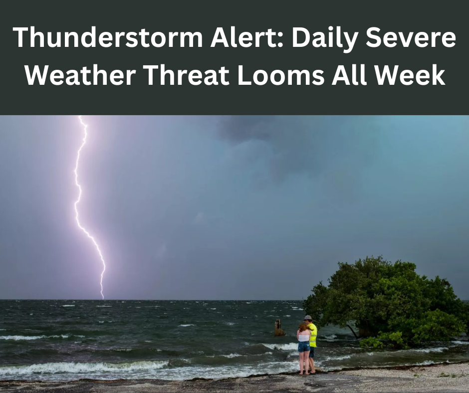
Today’s Thunderstorm Alert: Muggy Conditions and Spotty Showers
Thunderstorm Alert is in effect today as conditions turn hot and humid, with scattered showers developing throughout the day. Morning activity is expected to remain light, especially south of the Beltway. However, as the afternoon progresses, high temperatures between 85 to 90 degrees combined with elevated dew points will set the stage for isolated thunderstorms.
- Highs: 85–90°F
- Humidity: Dew points in the mid-70s
- Winds: Southeast at 5 mph
- Storm chance: 40% (mainly after 2 p.m.)
Evening hours could bring a few lingering storms, followed by muggy and partly cloudy overnight conditions with lows ranging from 70 to 75 degrees.
Tuesday Brings the Week’s Strongest Thunderstorm Alert
Tuesday carries the strongest Thunderstorm Alert of the week. Forecast models suggest a powerful cold front will move through the region, enhancing storm development. The combination of oppressive heat and humidity will push heat indices between 100 and 105°F, creating a volatile atmosphere primed for thunderstorms capable of damaging winds, flooding rains, and frequent lightning.
- Highs: 90–95°F
- Heat Index: 100–105°F
- Storm threat: High, especially after 2 p.m.
- Winds: West at 5–10 mph (stronger in storms)
Evening hours may continue to see isolated showers or storms, with mostly cloudy skies overnight and lows in the low-to-mid 70s.
Midweek Thunderstorm Alert: Risk Persists Wednesday and Thursday
The Thunderstorm Alert remains in place for both Wednesday and Thursday. Although storms may not be as widespread as on Tuesday, the risk of locally heavy rainfall and flash flooding remains.
- Wednesday: Partly sunny, very humid, scattered afternoon and evening storms
- Thursday: Similar pattern, with slightly better storm coverage in the southern parts of the area
Both days will feature highs near 90°F and lows in the mid-70s. Forecasters warn that any storms which do form may be slow-moving, increasing the risk of localized flooding.
End-of-Week Thunderstorm Alert: Storms Taper, But Chances Remain
From Friday through Sunday, the Thunderstorm Alert continues but becomes slightly less intense. The stalled frontal system driving much of the week’s storm activity will begin to dissipate. However, residual moisture and lingering instability will allow afternoon storms to persist, though with reduced intensity and coverage.
- Friday to Sunday: Partly sunny with a 40% chance of afternoon and evening storms
- Highs: 85–90°F
- Lows: 70–75°F
- Humidity: Remains high, adding to discomfort
Residents should still keep umbrellas and rain gear handy heading into the weekend.
Thunderstorm Alert Historical Context: Dangerous Weather on This Date
Today marks significant weather anniversaries in the region. On this date in 2012, the temperature hit 105°F—just one degree short of D.C.’s all-time high. In 2020, a record-setting 2.04 inches of rain fell as a series of thunderstorms swept through the area, causing flash floods, downed trees, and widespread power outages.
These past events highlight why it’s important to take every Thunderstorm Alert seriously, especially when forecasts point to similar conditions.
Three Key Takeaways from This Week’s Thunderstorm Alert
- Heat and Humidity: Expect daily highs in the upper 80s and low 90s, with oppressive humidity pushing heat indices into triple digits.
- Storm Timing: Most storms will develop during the afternoon and evening hours, although overnight storms can’t be ruled out.
- Localized Risks: Heavy rain, gusty winds, lightning, and flash flooding are all possible during any thunderstorm this week.
Tips for Staying Safe During a Thunderstorm Alert
When under a Thunderstorm Alert, it’s important to stay weather-aware:
- Check the forecast before making outdoor plans.
- Download a reliable weather app for real-time radar and alerts.
- Avoid flood-prone areas and never attempt to drive through standing water.
- Charge electronic devices in case of power outages.
- Postpone outdoor events during active alerts, especially in the afternoon.
What We’re Watching: Thunderstorm Alert Into the Weekend
Meteorologists continue to monitor the potential for strong thunderstorms through the end of the week. Rainfall estimates range from 2 to 4 inches, with isolated areas seeing up to 10 inches where storms repeatedly track over the same areas.
A cold front expected midweek will provide the most energy for storm development. The forecast calls for increased storm coverage on Tuesday, followed by tapering rain chances into the weekend. However, with moisture still in place, any day this week could bring sudden thunderstorm development.
Final Word: Stay Alert as Thunderstorm Risks Persist
With daily chances of thunderstorms, residents across the region should remain on high alert. From extreme heat to heavy rainfall and damaging winds, this week’s weather is anything but ordinary. The ongoing Thunderstorm Alert is a reminder to stay weather-aware, plan ahead, and prioritize safety during unpredictable conditions.
Read more: Tesla Stock Falls