Florida Tropical Depression: Possible Storm Formation Near Southeast Coast Over Holiday Weekend
Florida Tropical Depression: What’s Brewing This Fourth of July Weekend?
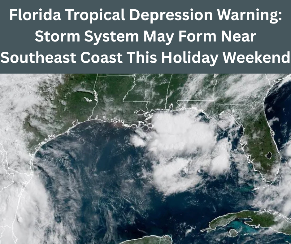
A Florida Tropical Depression may develop during the Fourth of July holiday weekend, bringing unsettled weather to the Sunshine State and beyond. The National Hurricane Center (NHC) is closely monitoring a low-pressure system near Florida and off the Southeast coast, warning that this disturbance could evolve into either a subtropical or fully tropical depression by early next week.
Even if the system doesn’t reach tropical status, it is expected to generate heavy rains, gusty winds, and stormy conditions across Florida, southeast Georgia, and the coastal Carolinas. Vacationers, residents, and boaters should prepare for intermittent thunderstorms and possibly dangerous beach conditions.
Florida Tropical Depression: Early Signs and Forecasted Development
The initial stage of a Florida Tropical Depression typically begins when a dissipating cold front leaves behind a weak low-pressure area over warm coastal waters. According to the NHC, atmospheric conditions remain only marginally favorable, so development is likely to proceed slowly.
If the low-pressure system becomes more organized, a subtropical or tropical depression could form sometime between Saturday and Monday. However, forecasters emphasized that even if the system strengthens into a named storm, it would likely remain weak and disorganized due to less supportive environmental conditions.
Meteorologists report that should it reach tropical-storm strength, it would receive the name “Chantal.”
Florida Tropical Depression: Areas of Concern and Rainfall Outlook
Regardless of formation, a Florida Tropical Depression poses significant threats, particularly from heavy rainfall. NHC models predict waves of showers moving through Florida and spilling northward into southeast Georgia and the Carolinas. Flash flooding becomes a concern due to repeated downpours through the holiday weekend.
Rainfall forecasts suggest between 2 to 4 inches of rain, with isolated pockets receiving even higher amounts. Beachgoers may need to monitor localized flooding and lightning risk. Rip currents may also become hazardous, so swimmers should avoid entering the water if warning flags are posted.
Florida Tropical Depression: Timing, Rain, and Storm Bands
Expect rainy weather to come in distinct bands, not just the typical afternoon showers. These persistent storm clusters can move slowly and overlap, raising the risk of flash flooding in low-lying areas. The forecast warns that rainfall may be more widespread than usual and could linger across multiple days.
Residents and visitors are encouraged to maintain a weather-aware approach, as conditions may shift rapidly. Lightning, gusty winds, and sudden downpours may affect outdoor plans throughout Saturday and Sunday.
Florida Tropical Depression: Beach Safety and Rip Current Alert
A developing Florida Tropical Depression increases rip current danger across the Southeast coast. Coastal authorities urge flags to be observed: red flags signal dangerous conditions, and swimmers should stay ashore. Even experienced swimmers can be caught in strong currents and choppy surf.
Beachgoers should have a backup plan—seek shelter indoors, near substantial buildings, during thunderstorms. Lifeguards and local officials will provide updates on water conditions throughout the holiday weekend.
Florida Tropical Depression: Why Conditions Favor Development
Several factors boost the potential for a Florida Tropical Depression to form:
- Marginally Favorable Waters: Sea surface temperatures are currently between 84°F and 88°F—warm enough to support tropical development if other conditions align.
- Lingering Front Activity: A dissipating cold front could provide the spin, or vorticity, that helps spawn a tropical depression.
- Support from Weather Models: Both the American (GFS) and European (ECMWF) models show low-pressure centers forming east of Florida, over the Gulf Stream. A secondary spin in the Gulf of Mexico is also possible.
These ingredients could combine to spark weak organization and possibly classify the system as a subtropical or tropical depression.
Florida Tropical Depression: Subtropical vs. Tropical—What’s the Difference?
If the system forms closer to a cold front or jet stream influence, it may qualify as a subtropical depression—characterized by a hybrid structure and more widespread wind fields, possibly reaching 40 mph gusts. In contrast, a purely tropical system would be more compact and concentrated around a warm-core low.
Both types, however, can produce heavy rain, gusty winds, and rough seas, which are the primary concerns for impacted areas, rather than whether the system earns a tropical classification.
Florida Tropical Depression: Official Outlook and Next Steps
The National Hurricane Center currently gives a 50% chance of development within the next seven days, with an additional 10% chance expected in the short term. A formal outlook map from the NHC highlights the zone of potential organization near Florida’s eastern coast.
Meteorologists will release updated outlooks daily, tracking whether the system gains definition and how the rainfall threat shifts. Mobile alerts, weather apps, and NOAA radios should be monitored for updated watches or warnings.
Florida Tropical Depression: Preparing for the Long Weekend
With the possible formation of a Florida Tropical Depression, here’s how to prepare:
- Stay Informed: Follow updates from the NHC and local weather stations.
- Plan for Rain: Have umbrellas, waterproof gear, and accessible shelter during outdoor activities.
- Track Rip Current Status: Swim only when beaches are open and lifeguards permit.
- Anticipate Flash Flooding: Avoid low-lying roads prone to flooding, and never drive into high water.
- Secure Equipment: Tie down pool inflatables, patio items, and other light objects that can blow away.
Florida Tropical Depression: What to Watch in the Coming Days
The next few days will determine whether a Florida Tropical Depression emerges from the current low-pressure zone. While no strong hurricane is expected, the anticipated disturbances could significantly impact holiday plans with rain and beach closures.
Stay weather-aware, allow flexibility in your activities, and download reliable forecast tools. Whether rainbands linger over Miami, confusing clouds drift through Jacksonville, or rip currents intensify along New Smyrna Beach, preparedness can make the difference between a disrupted holiday and a safe celebration.
Read more: Trump Megabill Final Passage
[…] Crash: Liverpool Star and Brother Reportedly Die in Tragic Accident, Says Spanish Civil Guard Florida Tropical Depression Warning: Storm System May Form Near Southeast Coast This Holiday Weeken… Skydiving Plane Crash Cross Keys Airport: 14 Injured in Gloucester County Accident Trump […]